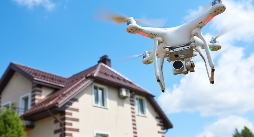
In the competitive world of real estate, presentation is everything. The way a property is showcased can make or break a sale. That’s why more realtors, brokers, and property managers are turning to drones as a powerful marketing and surveying tool. With aerial photography and videography, real estate professionals can capture breathtaking angles, highlight property features, and attract more serious buyers. But beyond the buzz, how exactly are drones revolutionizing the real estate industry?
Aerial Visuals That Sell
One of the most obvious advantages drones offer is the ability to take stunning aerial shots of homes, land, and commercial properties. Traditional photography is limited to ground-level views, which can miss the scale, layout, and surrounding environment. Drones provide:
- Bird’s-eye views of entire properties
- Dynamic flythroughs of homes and interiors
- Contextual surroundings like nearby parks, schools, and roadways
- Virtual tours that can be guided from above
These features aren’t just eye candy—they provide buyers with useful information and emotional connection, helping them envision life in the home before they even visit.
Commercial Property Applications
Drones aren’t just for residential listings. They’ve also become essential for marketing and managing commercial real estate. Drone imagery is used to:
- Highlight proximity to infrastructure and highways
- Showcase large industrial or retail spaces
- Provide updates to investors and stakeholders
- Survey land for potential development
For commercial clients, high-quality drone footage shows the scale and business potential of a property like nothing else.
Time and Cost Efficiency
Using drones can save both time and money. Compared to hiring a helicopter or manually capturing images of larger properties, drones are far more efficient and cost-effective. Drone operators can quickly gather high-resolution footage and photographs in just a few hours, giving real estate professionals faster turnaround times.
Data Gathering and Mapping
Beyond photography, drones can be used to create 2D orthomosaic maps and 3D models of properties. This is especially valuable for:
- Builders planning new developments
- Landowners assessing terrain
- Architects creating site plans
This level of data collection, when combined with visual storytelling, adds an entirely new dimension to the way properties are marketed and developed.
FAA Compliance and Legal Operation
If you’re using drones in real estate, it’s not just about flashy videos—it’s about flying legally and responsibly. Any commercial drone use in the U.S., including real estate, requires a Part 107 Remote Pilot Certificate from the FAA. Violating this rule can lead to fines and legal consequences for both pilots and real estate firms.
Want to learn more about why flying legally matters? Check out our article: Why It’s Important to Fly Drones Legally in Real Estate
Learn the Basics First
If you’re new to using drones for real estate or want a quick primer, we’ve already covered the fundamentals in our first article. You can check it out here: Intro to Real Estate Drone Photography
Final Thoughts
Drones are no longer just a trend in real estate—they’re a necessity. Whether it’s capturing aerial video, generating 3D models, or highlighting commercial developments, drones give real estate professionals a high-tech advantage in a competitive market. But to use them effectively, it’s essential to pair creativity with compliance. Train well, get certified, and let your drone do the flying—and the selling.
Leave a Reply